Talk to us

 Send Inquiry
GARMIN GPS MAP 64
MOQ : 1 Box
GARMIN GPS MAP 64 Specification
- Features
- Rugged, water-resistant (IPX7), waypoint navigation, track & route recording
- Interface Type
- USB interface, NMEA 0183 compatible
- Usage & Applications
- Geocaching, navigation, outdoor adventure touring
- Memory Size
- 4 GB internal memory, microSD card slot
- Type
- Handheld Navigator
- Usage
- Outdoor navigation, trekking, hiking, geolocation
- Function
- Handheld GPS navigation and mapping
- Dimensions
- 6.1 x 16.0 x 3.6 cm
- Weight
- Approx. 260 g with batteries
- Network
- Supports GPS & GLONASS satellite systems
- GPS Accuracy
- Approx. 3-5 meters (with WAAS enabled)
- GPS Sensitivity
- High-sensitivity GPS and GLONASS receiver with a quad helix antenna
- Battery Backup
- Up to 16 hours
- Display
- 2.6-inch sunlight-readable color display (160 x 240 pixels)
- Frequency
- 1,575 MHz (L1 band)
- Custom POIs
- Yes (ability to add custom points of interest)
- Photo Navigation
- Yes (navigate to geotagged photos)
- Preloaded Maps
- Worldwide basemap
- Waypoints
- 2000 waypoints, 200 routes
- Water Rating
- IPX7
- Trip Computer
- Yes
- Unit-to-Unit Transfer
- Yes (sharing data wirelessly between compatible devices)
- Track Log
- 10,000 points, 200 saved tracks
- Battery Type
- 2 AA batteries (not included; NiMH or Lithium recommended)
- Electronic Compass
- Yes, 3-axis tilt-compensated
- Barometric Altimeter
- Yes
About GARMIN GPS MAP 64
| Physical & Performance | |
| Physical dimensions | 2.4" x 6.3" x 1.4" (6.1 x 16.0 x 3.6 cm) |
| Display size, WxH | 1.43" x 2.15" (3.6 x 5.5 cm); 2.6" diag (6.6 cm) |
| Display resolution, WxH | 160 x 240 pixels |
| Display type | transflective, 65-K color TFT |
| Weight | 8.1 oz (230 g) with batteries |
| Battery | 2 AA batteries (not included); NiMH or Lithium recommended |
| Battery life | 16 hours |
| IPX7 | |
| High-sensitivity receiver | Yes |
| Interface | USB and NMEA 0183 compatible |
| Maps & Memory | |
| Basemap | Yes |
| Ability to add maps | Yes |
| Built-in memory | 4GB |
| Accepts data cards | microSD card (not included) |
| Custom POIs (ability to add additional points of interest) | Yes |
| Waypoints/favorites/locations | 5000 |
| Routes | 200 |
| Track log | 10,000 points, 200 saved tracks |
| Outdoor Features | |
| Automatic routing (turn by turn routing on roads) | Yes (with optional mapping for detailed roads) |
| Geocaching-friendly | Yes (Paperless) |
| Yes | |
| Hunt/fish calendar | Yes |
| Sun and moon information | Yes |
| Tide tables | Yes (with optional Bluechart) |
| Area calculation | Yes |
| Picture viewer | Yes |
Unmatched Precision and Durability
Engineered for reliability, the GARMIN GPS MAP 64 delivers excellent performance in diverse outdoor environments. Its rugged design features IPX7 water resistance, making it suitable for all weather conditions. The high-sensitivity GPS and GLONASS receiver ensures fast and accurate location tracking, even in dense forests or deep valleys. Ideal for adventurers who demand durability and precision.
Comprehensive Navigation Features
This handheld GPS offers a wide array of navigation tools, including waypoint marking, route recording, and track saving. The preloaded worldwide basemap, geotagged photo navigation, and compatibility with custom POIs enable tailored navigation experiences. Users benefit from the barometric altimeter for elevation data and the electronic compass for precise directional guidance.
Extended Battery Life and User Flexibility
Powered by two AA batteries (not included), the GPS MAP 64 provides up to 16 hours of operation. Thanks to its lightweight construction and ergonomic design, its convenient for long treks and outdoor excursions. The expandable memory via microSD and the ability to transfer data wirelessly between units further increase its versatility.
FAQs of GARMIN GPS MAP 64:
Q: How do I power the GARMIN GPS MAP 64 and what battery types are recommended?
A: The device is powered by two AA batteries, which are not included. For optimal performance and longer battery life, NiMH or Lithium batteries are recommended.Q: What types of outdoor activities is the GARMIN GPS MAP 64 best suited for?
A: This handheld GPS is ideal for outdoor navigation activities such as hiking, trekking, geocaching, and adventure touring. Its rugged construction and advanced navigation features make it suitable for exploration in various terrains.Q: Where can I use the GARMIN GPS MAP 64, and how water-resistant is it?
A: You can use the GPS MAP 64 in virtually any outdoor environment. It has an IPX7 water rating, meaning it can resist water exposure up to 1 meter of depth for 30 minutes, making it suitable for rainy or wet conditions.Q: How can I store and manage waypoints, routes, and tracks on the device?
A: The GPS MAP 64 allows for the storage of up to 2,000 waypoints, 200 routes, and 10,000 track log points. You can save and organize routes directly on the device, and transfer data between compatible units wirelessly or through USB.Q: What process is involved in navigating to a geotagged photo location?
A: With Photo Navigation, simply upload a geotagged image to the device. The GPS MAP 64 will recognize the coordinates and guide you to that precise location on the map.Q: What are the benefits of the 3-axis electronic compass and barometric altimeter?
A: The built-in 3-axis tilt-compensated electronic compass provides accurate bearing even when holding the device at an angle, while the barometric altimeter offers precise elevation readings, enhancing overall navigation accuracy.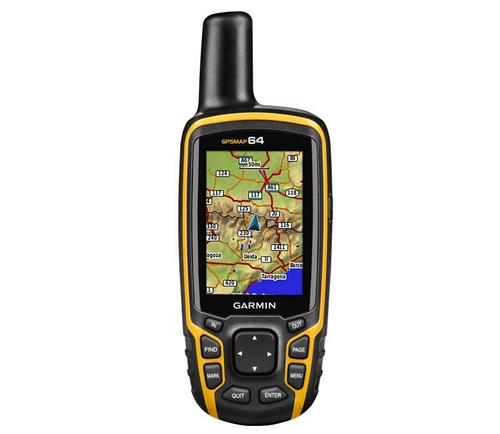
Tell us about your requirement

Price:
Quantity
Select Unit
- 50
- 100
- 200
- 250
- 500
- 1000+
Additional detail
Mobile number
Email

HINDUSTAN ARMY STORE
GST : 06ADEPB4243K1ZU
GST : 06ADEPB4243K1ZU

Mr. D J SINGH
(Director)
Mobile : +919416146360, +919671625109
SHOP NO 1, GITA ASHRAM MKT, LAL KURTI ROAD, Ambala Cantt - 133001, Haryana, India

Quick Link
Developed and Managed by Infocom Network Private Limited.
