Talk to us

 Send Inquiry
GARMIN GPS MAP 78S
MOQ : 1 Box
GARMIN GPS MAP 78S Specification
- Interface Type
- USB, NMEA 0183
- Features
- Waterproof (IPX7), built-in worldwide basemap, customizable data fields, electronic compass, barometric altimeter
- Memory Size
- Built-in: 1.7 GB; microSD card slot for expansion
- Usage & Applications
- Navigation, tracking, geocaching, marine charting
- Type
- Handheld GPS receiver
- Usage
- Marine, outdoor activities, hiking, boating
- Function
- Handheld GPS navigation, mapping, waypoint marking
- Dimensions
- 157 x 66 x 36 mm
- Weight
- 218.3 g (with batteries)
- Network
- GPS/WASS/GLONASS
- GPS Accuracy
- 3-5 meters (typical)
- GPS Sensitivity
- High-sensitivity, WAAS-enabled, HotFix satellite prediction
- Battery Backup
- Up to 20 hours with 2 AA batteries
- Display
- 2.6 TFT, 65K colors, sunlight-readable
- Frequency
- Not applicable (uses GPS frequency bands)
- Waypoints
- 2000 locations
- Trip Computer
- Yes (distance, speed, time)
- Tide Tables
- Yes
- Routes
- 200 routes
- Unit-to-Unit Transfer
- Wireless sharing of waypoints, routes, tracks, and geocaches
- Geocaching Friendly
- Yes (paperless geocaching support)
- Auto Calibration
- Yes (compass and altimeter auto-calibrate)
- Waterproof Rating
- IPX7 (waterproof up to 1 meter for 30 minutes)
- PC Connectivity
- USB mass storage
- Battery Type
- 2 AA batteries (alkaline, NiMH, or lithium recommended)
- User Interface
- Rocker key pad
- Sun and Moon Info
- Yes
- Track Log
- 10,000 points, 200 saved tracks
- Map Capabilities
- Preloaded worldwide basemap, supports custom maps, BlueChart g2, BirdsEye Satellite Imagery
About GARMIN GPS MAP 78S
| Physical & Performance: | |
| Unit dimensions, WxHxD: | 2.6" x 6.0" x 1.2" (6.6 x 15.2 x 3.0 cm) |
| Display size, WxH: | 1.6" x 2.2" (4.1 x 5.6 cm); 2.6" diag (6.6 cm) |
| Display resolution, WxH: | 160 x 240 pixels |
| Display type: | transflective, 65-K color TFT |
| Weight: | 7.7 oz (218.3 g) with batteries |
| Battery: | 2 AA batteries (not included); NiMH or Lithium recommended |
| Battery life: | 20 hours |
| Waterproof: | yes (IPX7) |
| Floats: | yes |
| High-sensitivity receiver: | yes |
| Interface: | high-speed USB and NMEA 0183 compatible |
| Maps & Memory: | |
| Basemap: | yes |
| Ability to add maps: | yes |
| Built-in memory: | 1.7 GB |
| Accepts data cards: | microSD card (not included) |
| Waypoints/favorites/locations: | 2000 |
| Routes: | 200 |
| Track log: | 10,000 points, 200 saved tracks |
| Features: | |
| Automatic routing (turn by turn routing on roads): | yes (with optional mapping for detailed roads) |
| Electronic compass: | yes (tilt-compensated, 3-axis) |
| Touchscreen: | no |
| Barometric altimeter: | yes |
| Camera: | no |
| Geocaching-friendly: | yes (paperless) |
| Custom maps compatible: | yes |
| Photo navigation (navigate to geotagged photos): | yes |
| Outdoor GPS games: | no |
| Hunt/fish calendar: | yes |
| Sun and moon information: | yes |
| Tide tables: | yes |
| Area calculation: | yes |
Rugged, Waterproof Design
Engineered for durability, the GARMIN GPS MAP 78S features an IPX7 waterproof rating, ensuring reliable operation in wet marine environments or during rainy outdoor expeditions. Its robust housing floats on water, offering peace of mind to boaters and hikers alike.
Advanced Mapping and Customization
Preloaded with a worldwide basemap, the GPS MAP 78S supports custom mapping solutions, BlueChart g2 marine charts, and BirdsEye Satellite Imagery. This flexibility allows users to tailor mapping capabilities to their precise navigation needs for land or sea.
Efficient Navigation and Data Management
With storage for up to 2,000 waypoints, 200 routes, and 10,000 track log pointsplus wireless data sharing and USB connectivityusers can effortlessly manage navigation data, share information with other Garmin units, and plan routes for future adventures.
FAQs of GARMIN GPS MAP 78S:
Q: How do I create and manage waypoints on the GARMIN GPS MAP 78S?
A: To manage waypoints, use the rocker keypad to mark your current location or input coordinates directly. The device stores up to 2,000 waypoints, which can be named, categorized, and navigated to easily, providing vital markers for trails or marine routes.Q: What mapping options are available for the Garmin GPS MAP 78S, and how can they be used?
A: The MAP 78S comes with a preloaded worldwide basemap and supports additional mapping through microSD, such as custom maps, BlueChart g2 for marine navigation, and BirdsEye Satellite Imagery for detailed landscape visuals, enabling precise and flexible navigation for various activities.Q: When should I replace the batteries and which types are recommended for optimal use?
A: Replace the two AA batteries (alkaline, NiMH, or lithium) when the device indicates low power or after approximately 20 hours of usage. For extended trips, lithium batteries are recommended due to their longer life and better performance in extreme temperatures.Q: Where can the GPS MAP 78S be effectively used?
A: This device is designed for a range of environments, including boating, marine navigation, hiking, outdoor adventures, and geocaching. Its waterproof construction and buoyant design make it particularly effective for water-based and wet conditions.Q: What is the process for transferring data between GPS units?
A: With wireless unit-to-unit transfer, you can share waypoints, routes, tracks, and geocaches with other compatible Garmin devices. Simply use the menu to select the data you wish to transfer and follow the prompts for quick sharing in the field.Q: How does the electronic compass and barometric altimeter benefit users?
A: The electronic compass provides accurate directional information while stationary, and the barometric altimeter measures precise elevation changes, both of which automatically calibrate, assisting with orientation, navigation, and weather trend tracking during outdoor activities.Q: What are the main advantages of using the GPS MAP 78S for geocaching?
A: With paperless geocaching support, users can download and store geocache details directly, eliminating the need for printed notes. Fast GPS accuracy, large waypoint capacity, and robust mapping make it easy to search, track, and log geocaches efficiently.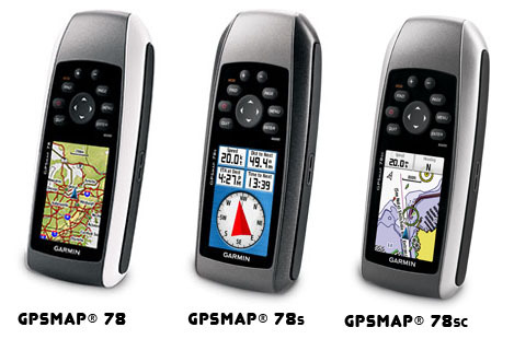
Tell us about your requirement

Price:
Quantity
Select Unit
- 50
- 100
- 200
- 250
- 500
- 1000+
Additional detail
Mobile number
Email

HINDUSTAN ARMY STORE
GST : 06ADEPB4243K1ZU
GST : 06ADEPB4243K1ZU

Mr. D J SINGH
(Director)
Mobile : +919416146360, +919671625109
SHOP NO 1, GITA ASHRAM MKT, LAL KURTI ROAD, Ambala Cantt - 133001, Haryana, India

Quick Link
Developed and Managed by Infocom Network Private Limited.
