Talk to us

 Send Inquiry
GARMIN GPS OREGON 650
MOQ : 1 Box
GARMIN GPS OREGON 650 Specification
- Weight
- 209 g with batteries
- Interface Type
- USB
- Usage & Applications
- Outdoor navigation, mapping, waypoint marking, geocaching
- Memory Size
- 1.5 GB internal with microSD card support
- Features
- Dual battery system, 8 MP autofocus camera, wireless connectivity, 3-axis compass, barometric altimeter
- Type
- Handheld GPS
- Usage
- Handheld GPS device for hiking, trekking, geocaching, and adventure
- Function
- Outdoor navigation and mapping
- Dimensions
- 6.1 x 11.4 x 3.3 cm
- Network
- None (standalone GPS device)
- GPS Accuracy
- Up to 3-5 meters
- GPS Sensitivity
- High-sensitivity GPS and GLONASS receiver
- Battery Backup
- Up to 16 hours with NiMH rechargeable or AA batteries
- Display
- 3-inch sunlight-readable touchscreen
- Compass
- 3-axis electronic
- Internal Memory
- 4GB (internal memory)
- User Interface
- Multi-language support
- USB Support
- USB 2.0
- Track Log
- 10,000 points, 200 saved tracks
- Altimeter
- Barometric
- Trip Computer
- Yes
- Mounting Options
- Multiple mount support for bike, car, belt clip
- Water Resistance
- IPX7-rated waterproof
- Waypoints
- Up to 4000 waypoints
- Camera
- 8 Megapixel autofocus camera with flash & digital zoom
- Routes
- 200 saved routes
- Operating Temperature Range
- -20C to 60C
- Map Compatibility
- Compatible with Garmin TOPO, BirdsEye Satellite Imagery, Custom Maps
- Wireless Transfer
- Bluetooth, ANT+ compatible
- Battery Type
- Rechargeable NiMH or 2x AA batteries
- Photo Geotagging
- Location data automatically embedded in photos
About GARMIN GPS OREGON 650
| Physical & Performance | |
| Physical dimensions | 2.4" x 4.5" x 1.3" (6.1 x 11.4 x 3.3 cm) |
| Display size, WxH | 1.5"W x 2.5"H (3.8 x 6.3 cm); 3" diag (7.6 cm) |
| Display resolution, WxH | 240 x 400 pixels |
| Display type | transflective color TFT touchscreen |
| Touchscreen | Yes |
| Weight | 7.4 oz (209.8 g) with batteries |
| Battery | rechargeable NiMH pack (included) or 2 AA batteries (not included); NiMH or Lithium recommended |
| Battery life | 16 hours |
| IPX7 | |
| High-sensitivity receiver | Yes |
| Interface | high-speed USB and NMEA 0183 compatible |
| Camera | yes (8 megapixel with autofocus; digital zoom) |
| Barometric altimeter | Yes |
| Electronic compass | Yes (tilt-compensated 3-axis) |
| Unit-to-unit transfer (shares data wirelessly with similar units) | Yes (plus images and custom maps) |
| Maps & Memory | |
| Basemap | Yes |
| Ability to add maps | Yes |
| Built-in memory | 4 GB |
| Accepts data cards | microSD card (not included) |
| Custom POIs (ability to add additional points of interest) | Yes |
| Waypoints/favorites/locations | 4000 |
| Routes | 200 |
| Track log | 10,000 points, 200 saved tracks |
| Outdoor Features | |
| Automatic routing (turn by turn routing on roads) | Yes (with optional mapping for detailed roads) |
| Geocaching-friendly | Yes (Paperless) |
| Yes | |
| Hunt/fish calendar | Yes |
| Sun and moon information | Yes |
| Tide tables | Yes |
| Area calculation | Yes |
| Picture viewer | Yes |
Advanced Mapping and Navigation
Unlock precise outdoor navigation with the Oregon 650, supported by high-sensitivity GPS/GLONASS receivers. Compatible with Garmin TOPO, BirdsEye Satellite Imagery, and Custom Maps, the device enables detailed waypoint marking and route planning for complex treks. A helpful trip computer, 3-axis electronic compass, and barometric altimeter deliver nuanced data for safe, confident exploration.
Robust Hardware for Any Expedition
Built to withstand unpredictable environments, the Oregon 650s IPX7 waterproof rating and operating temperature range of -20C to 60C ensure resilience. The sunlight-readable 3-inch touchscreen and flexible mounting options allow convenient use in diverse settingsfrom hiking trails to car dashboards. Weighing only 209 grams, it offers portability without compromising durability.
Seamless Wireless Connectivity and Geotagging
Bluetooth and ANT+ compatibility supports wireless transfer of data and pairing with sensors. The 8MP autofocus camera not only captures high-resolution images but also embeds location data, making it easy to document and share geotagged adventures. USB 2.0 provides quick, reliable transfer of waypoints, tracks, and photos to a computer.
FAQs of GARMIN GPS OREGON 650:
Q: How do I use the camera feature on the Garmin Oregon 650?
A: To use the 8MP camera, simply select the camera icon from the device menu, frame your shot on the 3-inch touchscreen, and capture photos. The camera automatically geotags location data for each image, making it easy to track where each picture was taken.Q: What batteries can I use with the Oregon 650, and how long does the battery last?
A: The Oregon 650 supports both rechargeable NiMH packs and standard AA batteries. With either option, the device delivers up to 16 hours of battery backup, ensuring reliable performance for extended outdoor excursions.Q: Where can I use the Oregon 650 for navigation?
A: This handheld GPS is designed for use in numerous outdoor environments, including hiking trails, mountainous regions, forests, and during activities like geocaching and trekking. Its waterproof IPX7 construction and wide operating temperature range ensure dependable operation in challenging conditions.Q: What is the data transfer process to share waypoints and photos?
A: You can transfer waypoints, tracks, routes, and photos wirelessly to compatible devices via Bluetooth or ANT+. Alternatively, use USB 2.0 to connect the device to a computer for rapid file transfers and backup management.Q: How does the Oregon 650 benefit outdoor adventurers?
A: The device combines advanced navigation tools, robust mapping compatibility, and photo documentation in a single, portable unit. Its high GPS accuracy (35 meters) and geotagging capacity streamline exploration, while multiple mount options and a sunlight-readable touchscreen cater to a variety of outdoor pursuits.Q: What mapping options are supported on the Oregon 650?
A: The Oregon 650 is compatible with Garmin TOPO maps, BirdsEye Satellite Imagery, and custom maps. This enables users to customize their navigation experience and access detailed terrain information suitable for any adventure.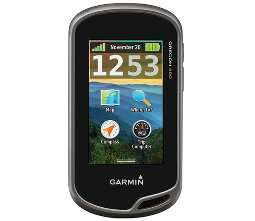
Tell us about your requirement

Price:
Quantity
Select Unit
- 50
- 100
- 200
- 250
- 500
- 1000+
Additional detail
Mobile number
Email

HINDUSTAN ARMY STORE
GST : 06ADEPB4243K1ZU
GST : 06ADEPB4243K1ZU

Mr. D J SINGH
(Director)
Mobile : +919416146360, +919671625109
SHOP NO 1, GITA ASHRAM MKT, LAL KURTI ROAD, Ambala Cantt - 133001, Haryana, India

Quick Link
Developed and Managed by Infocom Network Private Limited.
